Finding a mineral deposit can mean sending people across rough ground, into old workings, or near unstable rock. Robots could take on much of that early survey work while carrying sensors that collect more consistent readings.
For a mining company or geology team, the useful question is practical: can a robot gather better evidence about a site before people drill, build roads, or enter hazardous areas?
- Aerial robots can map ground with LiDAR and camera systems.
- Ground robots can collect soil, rock, and magnetic readings along set routes.
- Drilling robots still need human checks before a deposit makes economic sense.
Where robots can help first
Small aircraft can cover ground faster than a walking survey team, especially where roads are poor. A drone carrying LiDAR can measure the shape of the land, while RGB, multispectral, or hyperspectral cameras record differences in rock, soil, and plant cover.
Those readings can point to places worth checking on foot. They don't prove that lithium, nickel, copper, cobalt, or rare earth elements are present in useful amounts. They help narrow the search area.
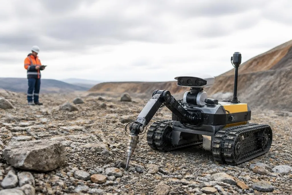
Ground robots add a second layer of evidence. A tracked rover can follow a planned route, record its position, and collect readings from the soil or exposed rock.
A magnetometer can measure changes in the local magnetic field, while an X-ray fluorescence sensor, known as XRF, can estimate the elements in a surface sample.
The value comes from repeatable work. A rover can return to the same route after rain, compare readings from different points, and keep people away from loose slopes or contaminated ground.
What happens underground
Underground work creates a different problem because satellite signals may not reach tunnels. Robots can use cameras, LiDAR, inertial sensors, and simultaneous localization and mapping, or SLAM, to build a map from their own movement and sensor readings.
A machine in a tunnel could inspect walls, carry a gas sensor, or gather samples near a planned drill site. Remote control may still be needed when the route is unknown, but the person operating the robot can remain outside the danger area.
Drilling is where the results become more useful to geologists. An automated drill rig can keep a steady feed rate, record depth, and label core samples. That record helps a team compare samples from separate holes instead of relying on notes taken in difficult conditions.
A drill record still can't tell you which minerals are present. That needs lab testing, with the sample method, depth, and test result recorded beside the machine that collected it. Reporting from Robot24 can put those details in the same record before the next section weighs where field robots fall short.
The limits are serious
A robot can collect data. It can't decide from one sensor reading that a mine should be built. Geologists still need to check samples, compare readings with the local rock structure, estimate the size and grade of a deposit, and study water, waste, access, and permits.
The ground can also defeat the machine. Dust can cover cameras. Water can damage electronics. Steep slopes can stop a rover, and a tunnel can block radio links. A drone may map the surface well while missing what lies below it.
Sampling creates another risk. A rover that follows the easiest route may collect data from the most accessible ground rather than the ground that best represents the site. The route, sensor settings, sample depth, and weather should all sit beside the result.
I'd fund robots for early surveys when the safety benefit and data record are clear, but I wouldn't treat a robot map as proof of a mineable deposit.
A buying checklist for survey teams
Use these checks before choosing a robot or sensor package:
- Define the decision: State whether the survey must select drill sites, map hazards, or measure surface chemistry.
- Match the sensor: Choose LiDAR for terrain shape, magnetometers for magnetic readings, and XRF for surface-element checks.
- Plan the route: Test slopes, loose rock, water, dust, signal loss, and battery changes before field work starts.
- Keep a human review: Set a process for checking samples and rejecting readings that lack location or depth data.
- Record the limits: Mark which areas the robot could not reach and which results still need drilling.
That checklist keeps the machine tied to a real decision. It also shows where a cheaper drone, rover, or sensor may do enough work without adding a full autonomous system.
The next useful test is simple: can the robot produce a repeatable map that leads to better drill targets while keeping people out of danger? Until a team can show that link at a real site, the robot remains a survey tool, not a mining solution.